
newsroom
〰️
newsroom 〰️
Zadar Labs Newsroom
At Zadar Labs, we’re shaping the future of perception technology. Here, you’ll find our latest announcements, product launches, partnerships, and industry insights. Explore how our radar innovations and collaborations are redefining what’s possible in mobility, automation, and intelligent sensing.
Zadar Labs Announces Free Path at CES 2026
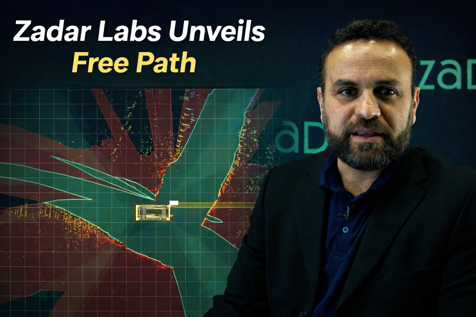
Zadar Labs introduces Free Path at CES 2026, a new capability enabled by high-resolution, wide field-of-view imaging radar. Built on Zadar’s Software-Defined Imaging Radar platform, Free Path delivers real-time free-space mapping that helps machines understand where they can safely move, even in complex and harsh environments.
A new free-space mapping capability enabled by Software-Defined Imaging Radar (SDIR™)
Las Vegas | CES 2026 | January 7, 2026
Zadar Labs today announced Free Path, a new feature built on its Software-Defined Imaging Radar (SDIR™) platform, unveiled at CES 2026 in Las Vegas. Free Path enables mobile platforms to understand where they can safely move by generating accurate, real-time free-space maps around vehicles and heavy machinery.
Free Path defines the average distance a platform can travel before encountering another platform or an obstacle, delivering a clear, measurable view of safe, drivable space. Enabled by Zadar’s high-resolution imaging radar and wide field of view, Free Path uses a combination of multiple imaging radars to detect humans, machines, and obstacles, then builds a complete 360-degree surround view. This approach supports safer operation in complex, real-world, and harsh environments where traditional sensing solutions struggle.
“Free Path is about clarity of vision and the safe operation of the vehicle,” said Mazi Taghivand, Chief Business Officer of Zadar Labs. “What is significant about Free Path is that it enables safe vehicle operation in all weather and lighting conditions. This capability is critical for both manned and unmanned operations. In heavy machinery, operators often face multiple blind spots around the vehicle. Free Path provides operators and autonomous systems with a precise, dynamic map of obstacle-free and drivable space in their environment.
Free Path defines safe, driveable space in real time, building a 360° view around vehicles and heavy machinery so operators and autonomous systems know not just what’s around them, but where they can safely go.
“The advantage of mmWave 4D imaging radar is that cameras cannot provide depth and velocity information and are severely compromised in adverse lighting and weather conditions. LiDAR systems also suffer in adverse weather, require high maintenance, and do not provide direct velocity information. Our radars are 4D (x, y, z, velocity), compared to LiDAR’s 3D (x, y, z). The velocity information provided by radar is extremely useful and computationally free. Free Path delivers the world’s highest resolution in range and angle, along with the widest field of view in both horizontal and vertical directions, made possible by our state-of-the-art, software-defined mmWave 4D imaging radar technology.”
Built on Zadar’s SDIR™ platform, Free Path supports free-space mapping at varying heights, enabling advanced use cases for complex vehicles such as cranes, tractors, industrial equipment, and autonomous mobile robots. This feature provides flexible, user-defined visual and audible collision warnings, along with real-time situational awareness.
Free Path is designed for scalability across autonomous systems, robotics, industrial automation, and heavy machinery, bringing robust perception and operator-focused safety to demanding applications.
Learn more at https://www.zadarlabs.com